Crossing Florida: swamps and forests
|
The little steamship that carried Muir from Savannah and down the coast of Georgia reached the small port of Fernandina, in the extreme northeastern corner of Florida, on October 15, 1867. There Muir “reached Florida, the so-called ‘Land of Flowers,’ that I had so long waited for ….” From the “rickety town” of Fernandina, and after buying some bread, he headed “for the shady, gloomy groves” and “started across the state by a gap hewn for the locomotive, walking sometimes between the rails, stepping from tie to tie, or walking on the strip of sand at the sides, gazing into the mysterious forest, Nature’s own.” He marveled at the vast, dense forests with the labyrinth of “armed vines” and especially noted the grand Magnolia Grandiflora with ferns and palmetto palms, along with occasional sandy ridges covered by longleaf and other pines. But after departing the comparatively easy railroad line, Muir walked on beyond in the wet swamps searching for rare and slightly drier hillocks on which to sleep. He marched on, cold and wet and without food: “Flowers and beauty I had in abundance, but no bread.”
It seems to me that Muir was less than inspired in his choice of route across Florida, in that it was a relatively direct transect that seemingly intentionally did not replicate the routes taken by earlier naturalist explorers that exposed them to many more highlights of Florida’s amazing biodiversity and natural wonders. Perhaps he was simply tired and determined to make “good time” across the northern Florida peninsula, with a vague idea that he would try to catch ship passage onward across the Gulf of Mexico and then on to Central and South America. It is not clear if Muir actually had a plan or by this time was simply following the most direct route he figured on his crude map and a vague notion of destination and purpose. |
|
Assuming that you've entering Florida by road (likely via Interstate highway 95), from the bridge over the St. Marys River, which forms the Georgia/Florida states boundary, admire the vast marshes and bottomland forests. You can reach the city of Fernandina Beach, Florida, by departing Interstate 95 and heading east by US Hwy 17 and FL Hwy 200/ A1A. To reunite with Muir’s seaward route, after reaching the city of Fernandina Beach turn toward the northern end of Amelia Island (a barrier island) and visit the original port town of Old Fernandina, then go on to see the Spanish-settlement era fort site at Fernandina Plaza Historic State Park and the Civil War-era Fort Clinch State Park, both at the north end of the island (separated from the south end of Cumberland Island, Georgia, by the sound where the St. Marys River reaches the Atlantic Ocean). If you wish, linger a while longer on an Atlantic Ocean beach by driving south on this same island to visit Amelia Island State Park at the southern end of the island. In this area you will be transecting the East Coast Greenway, which is currently being assembled and is intended to connect as a trail for cyclers and hikers between cities from Maine to Florida.
|

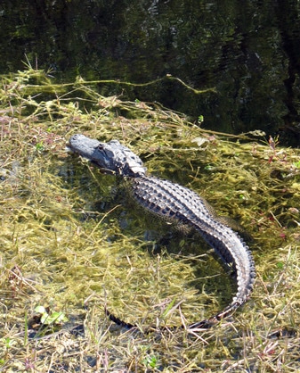
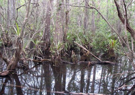
Immediately after reaching the port of Fernandina, Muir seems to have taken a southwestern direction into the flatwoods and swamps of Florida. Occasionally along the way Muir would flounder upon some barbaric loggers or hunters who took pity on him, offered him rough food, and warned him of ubiquitous, dangerous alligators. Sometimes he would emerge from the wet swamps to enjoy the more open and drier “barrens, hummock … savannas” with their more scattered but maze-like expanses of trees, grasses, ferns, and palmettos.
You may approximate his route west from Fernandina by way of driving west on FL Hwy 200/A1A (called “The Buccaneer Trail” highway). If you wish to recreate Muir’s first path along a railroad line, you will find that Hwy 200A briefly follows a segment of the present Seaboard Coast - CSXT railroad line. You might park your vehicle and for some sense of Muir’s experience, walk a short way along the railroad bed, before returning to your vehicle and crossing intersections with US Hwy 17 and then Interstate 95 and continuing southwest on GA Hwy 200. There, on the south side of Hwy 200, you will find Florida’s Four Creeks State Forest, consisting of 11,000 acres of flatwoods, swamps, bays, and tidal marsh with abundant wildlife and offering miles of public trails or hiking, biking, horse riding, canoeing and camping. These natural communities and habitats again closely approximate what Muir would have seen.
In Callahan, Hwy 200 joins US Hwy 301, by which you continue on Muir’s most likely course. You will find a similar terrain and dim vestiges of the native vegetation that Muir saw, but the landscape has been severely altered by agricultural and industrial pine plantations. Stop along Hwy 301/200 for a visit to the Cary State Forest, which is located north of your crossing with Interstate 10 and only about a dozen miles west of Jacksonville. This state forest contains expanses of longleaf pine/wiregrass savannas, other mature flatwoods, swamps, and cypress domes with a diversity of rare and common wildlife. Enjoy any of a variety of trails, boardwalks, and environmental education programs here.
South on Hwy 301/200 you can again divert slightly east of Muir’s route to tour Jennings State Forest, which encompasses a wide variety of natural community types including longleaf pine savannas, mesic and wet flatwoods, cypress swamps and ponds. You might wish also to drive through nearby Camp Blanding Wildlife Management Area, which is connected with the Camp Blanding National Guard training grounds.
In this region you will be passing through a cluster of natural lakes on either side of Hwy 301/200, but of which Muir makes no comment. South of the town of Starke, boat landings on several of those lakes are easily accessible from the highway for a quick impression and break from driving and provide public access for a little wildlife watching or even fishing.
This route crosses one of the main sections of the Florida Trail, one of the nation’s eleven national trails: the Palatka-to-Lake Butler State Trail constructed on a former Norfolk-Southern railroad line, near Keystone Heights (also see www.FloridaTrail.org and www.floridahikes.com ).
In the village of Waldo, you will leave Hwy 301/200 and take FL Hwy 24 west. Unless you have time for a more substantial detour northward, you will regrettably miss the 226,000-acre Osceola National Forest, with its extensive longleaf pine dominated forests and many lakes. Also you are crossing through the O-2-O project area that is designed to become a protected wildlife migration corridor connecting between the Osceola and Ocala National Forests and beyond (for more information explore www.floridawildlifecorridor.org and www.conserveflorida.org/preserving-greenways ).
Shortly on your way south from Waldo along Hwy 24, you will find the nearby 2,080-acre Austin Cary Memorial Forest and Learning Center. This is the learning and research forest for University of Florida’s School of Forestry and Conservation, where students learn applied forest management and conservation practices.
Muir’s route had climbed a few hundred feet in elevation and reached a few marginal roads “boring tunnels through forests” but with “much bridging” over wet sloughs. After several threatening encounters, and several days of walking, Muir reached Gainesville. He was favorably impressed by little Gainesville as “rather attractive” and “an oasis in the (wet) desert, compared with other villages. It gets its life from the few plantations located about it on dry ground that rises islandlike a few feet above the swamps.”
Today in the near vicinity of Gainesville you will find a number of interesting parks, natural areas, and museums that are easily accessible off FL Route 24 (called Waldo Road on the eastern side of Gainesville and Archer Road on the southwest side of the city). Linger a while here. Gainesville is home to the University of Florida. Perhaps simply drive out Hawthorne Road (Route 20) to the shore of large Newnans Lake, or better yet, bicycle from Gainesville’s Boulware Springs city park on all or part of the lovely public 16-mile-long Gainesville-Hawthorne Trail greenway along the northern side of Paynes Prairie Preserve and State Park. Be sure to walk out the La Chua Trail boardwalk and climb the observation tower to see Alachua Sink, where alligators often concentrate.
Definitely spend time visiting and admiring wildlife on both the north and south sides of the extensive wetland and forest preserve in Paynes Prairie Preserve State Park . You too will be astonished by its natural beauty and abundant, diverse wildlife (including a large population of alligators), just as the Colonial-era naturalist William Bartram was impressed. Yet John Muir made no comment about the natural wonders of Paynes Prairie. Perhaps he was intent simply on moving as fast as his legs could carry him. That was his lost opportunity: don’t miss this world-renowned natural area, where you will find extensive wet prairies and marsh, upland hardwood forests on the higher hammocks, and pine flatwoods on the uplands. These habitats host a large variety of birds and other wildlife, as well as large overwintering populations of waterfowl, sandhill cranes, hawks, and many migratory birds.
From Gainesville if you turn south from Hwy 24 onto US Hwy 441/FL 25 and the causeway crossing Paynes Prairie Preserve toward the main entrance to the state park and the town of Micanopy, there are several highway pull-offs from which to gain at least an overview of the wetlands and see some of the wildlife oblivious (or habituated) to human traffic. Very much worth your short detour is the historic town of Micanopy (only slightly south of Muir’s route), located immediately south of Paynes Prairie Preserve State Park. Micanopy is surrounded by nature preserves and important archaeological and early Colonial period sites – including Lake Tuscawilla (a Native American Heritage Preserve) and the hiking trail on Barr Hammock Preserve and Levy Prairie.
Also on the immediate southwest side of Gainesville (and easily accessible off Hwy 24-Archer Road) are several special stop-and-learn places: the Florida Museum of Natural History, one of the largest collection of ecological, archaeological, and anthropological exhibits in the southern U.S.; the Kanapaha Botanical Gardens, also associated with the University of Florida, which offers 1.5 miles of foot paths through woodlands, meadows, and bogs with collections and exhibits of Florida’s native flora and natural communities; and the Historic Haile Homestead, an 1850s restored farmstead only 3 miles west of Interstate 75, which displays the kind of Florida farm that Muir would have passed or visited for food and lodging.
>>>CONTINUE ON to journey's end at the Gulf . . .


